Getting Started
Open app.landmetric.org in any modern browser — no account required to explore the maps. Sign in is only needed for saving work or uploading data.
What is LandMetric?
LandMetric is a web-based spatial analysis platform developed under the CAPEO project. The platform was designed to provide non-GIS experts with easy access to curated Earth observation data and spatial indicators related to soil, vegetation, water, climate, socio-economic conditions, and risk assessment. It is built using open-source technologies, including GDAL and QGIS, and follows the SpatioTemporal Asset Catalog (STAC) specification. Released under the MIT License, the platform includes a robust web-based viewer, a flexible REST API, and a STAC data catalog.
Interface
- Themes & Datasets and Vector Layers panels (top-right icons) — browse and toggle layers, adjust opacity, and search by name.
- Map tools (top-left) — expands into five tools.
- Legend, time slider, and scale — located at the bottom of the map.
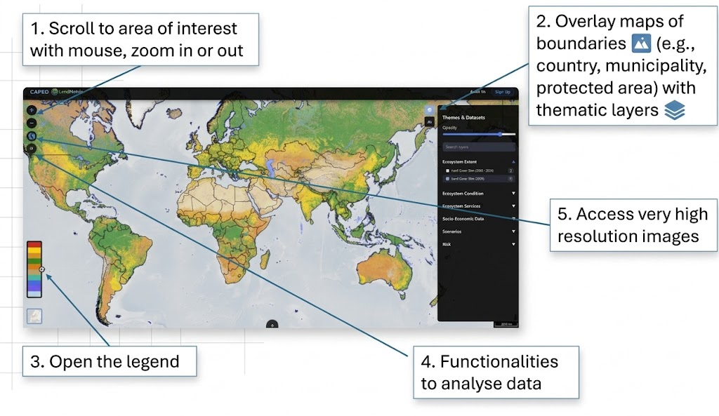
Quick steps
- Open app.landmetric.org.
- Browse the Themes & Datasets panel on the right.
- Click any layer name to add it to the map canvas.
- Check the legend of this selected layer on the left.
- Use the opacity slider to adjust transparency.
- Click the ⓘ button next to a layer for metadata.
- Switch basemaps (Grayscale / ESRI World / OSM) at the bottom of the left panel.
- Toggle vector overlays (boundaries, cadastre, etc.) under "Vector Layers".
Next: Map & Navigation →